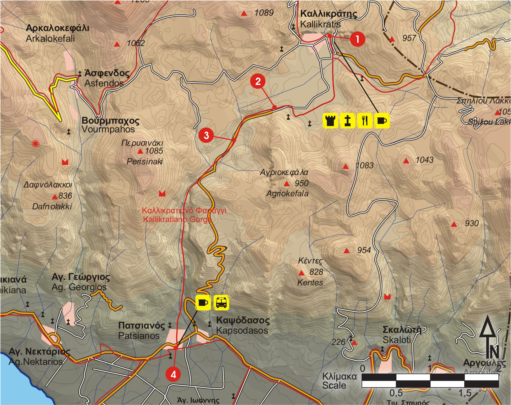
Departing from the church at Kallikratis, we come to a left turn (going to Asi Gonia), at the exit of the village (1); we ignore it and continue straight on, passing through a small plateau and a few scattered clusters of deserted houses.
After about 1.200 m, we see a low hill on our right, on top of which there is a chapel (2). Immediately after the hill, the road goes along the eastern bank of a dry water course, for 1.500 m.
At the point where the road moves away from the bank and turns left (3), the old yet distinct path begins, and crosses the stream bed many times, for approximately the next 30 minutes.
The gorge, then, begins to narrow and the path becomes very downhill.
Having walked for more than an hour from Kallikratis, the view of the area of Frangokastello appears in the distance. The last part of the gorge and of the stream bank is full of oleanders.
A little after the exit from the narrow section of the gorge, we climb onto the left (eastern) bank of the stream and follow the path parallel to it. After about 500 m, we pass by a cemetery and reach the main road between the villages Kapsodasos and Patsianos (4). At this point, we encounter the coastal branch of E4, which goes to the east, following the asphalt road.
Alternatively, for the last section, instead of climbing onto the left bank, we can follow the stream bed until the main road.


