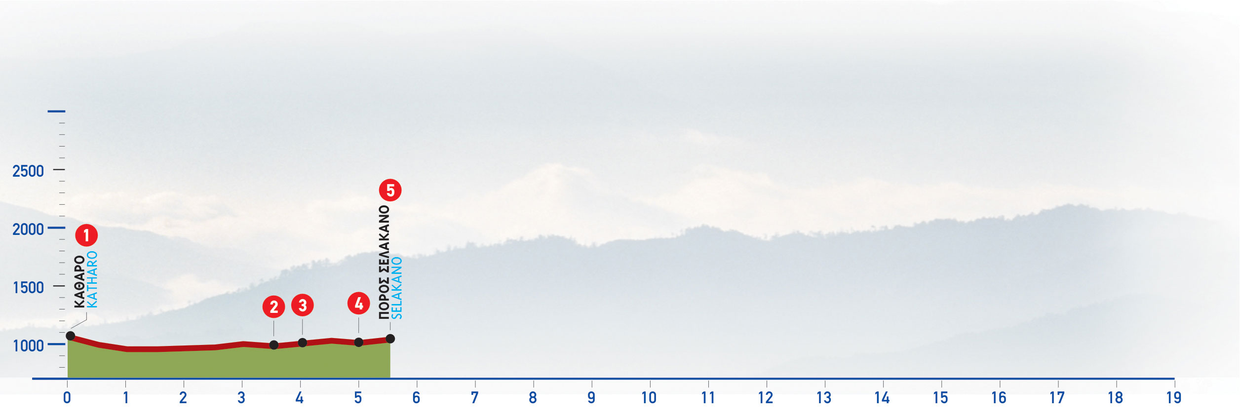
From the Katharo (1), we follow the dirt road which goes along the foot of the eastern slope of the plateau, in an easterly direction.
The main unsurfaced road which we follow now takes a southerly course. It initially passes through a cultivated area and small clusters of farmhouses, as well as a few isolated buildings; later on, uncultivated land dominates.
After some 4 km, the Katharo Plateau is behind us; we come to a left-hand side road (2) which we ignore and continue south-west, with a green slope on our right.
We carry on downhill on the main dirt road, which skirts around a characteristic rocky sandstone hill on its eastern side, and 500 m after the crossroads we come to a small chapel (3).
Approximately 900 m after the chapel, we cross a small stream, at a spot where there is a right-hand branch of the unsurfaced road (4) which we ignore and continue southwards for 750 m, in a pine-clad area.
At a location where there is a branch of the dirt road taking off diagonally on our right-hand side (5), almost parallel to the dirt road, a vague path that leads to Mathokotsana and Selakano begins.


