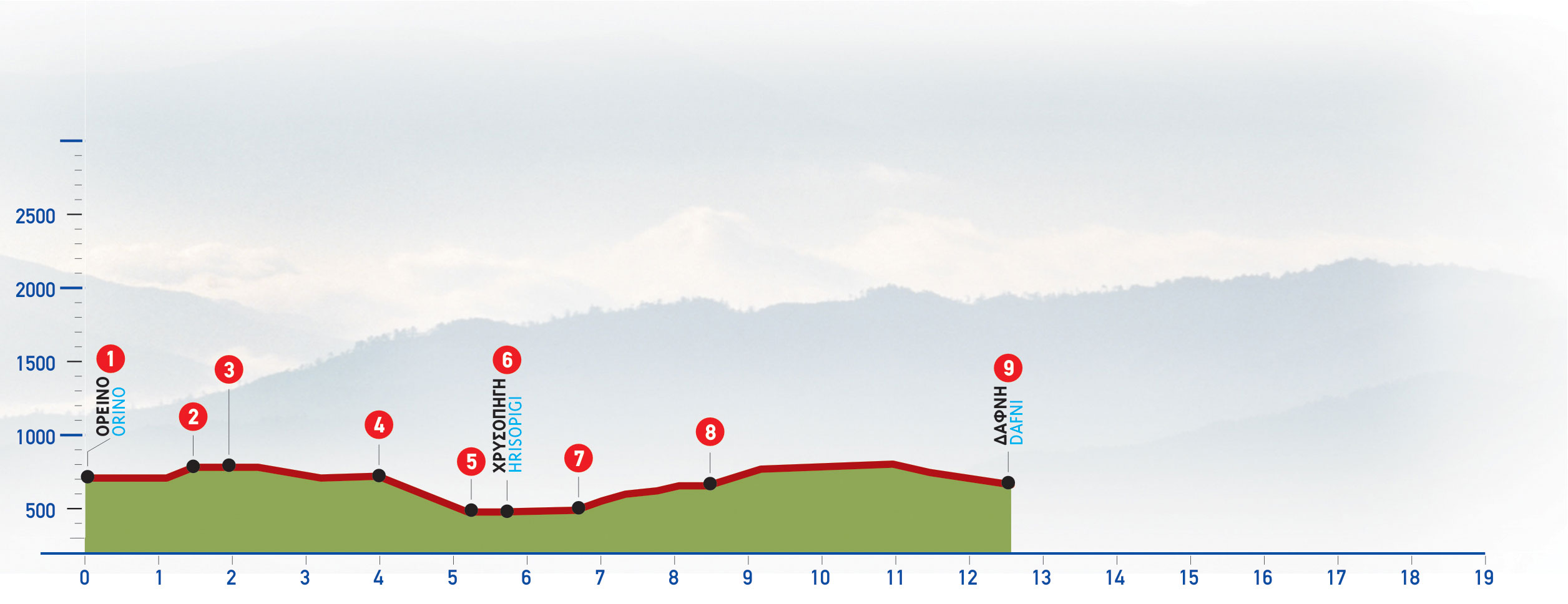
From the Orino village square (1), we follow the asphalt road eastwards for 1 km, to a saddle; once there, we turn left into a dirt road (2), which we follow for approximately 1.200 m, and then come upon a left side road (3). At this point, right (east) of the main dirt road we distinguish an old, vague footpath, which we follow.
Within a few metres on the path we come upon an electricity pole; having passed through a small flat area, approximately 20 minutes down the path, we reach a scree area which we cross through. Remnants of an old boundary fence can be seen on our right.
We walk parallel (north) to the boundary for about 10 minutes and then come to a dirt road where we turn right.
At the first crossroads, we continue downhill on our right for approximately 700 m, until we reach the main dirt road, at a point with another crossroads (4); there, we take the north-eastern downhill branch.
After 1.500 m, we descend to the eastern side of the valley of Chrysopigi, cross a small stream (5) and continue for another 800 m, to the centre of the settlement of Chrysopigi (6).
We follow the asphalt road from the eastern exit of Chrysopigi and, having reached a left bend, after 1 km, we come to a dirt road (7) which we take. We pass a characteristic pine tree and then the road leads us to the slope. We constantly walk eastwards, ignoring any turn-offs, and after 1.800 m we reach a main unsurfaced road (8), where we turn left (north-eastwards).
The valley of Chrysopigi and the Orino massif can be seen behind us, in the distance.
A little further on, we ignore a right-hand uphill turn-off; we continue straight on, until we reach the northern side of the hill, along which we walk, having the asphalt road down below to our left and the Koprokefàla massif to the north. After 2 km we arrive at Dafni (9).


