In the framework of the JoInOuT project, OAS has collected material on the environmental, cultural and tourist heritage for the following 5 routes of Sitia Geopark:
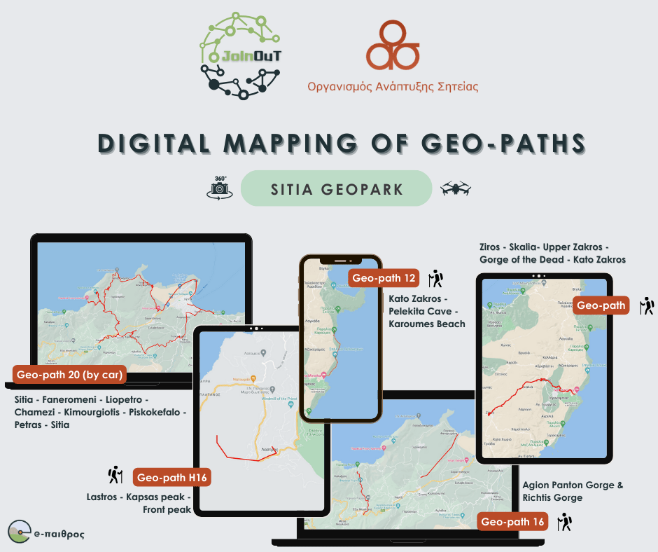
- Geotour 12: Kato Zakros – Pelekita Cave – Karoumes Beach.
- Geo-route 16: Agioi Panton Gorge, Rihti Gorge
- Ziros – Stairs – Upper Zakros – Gorge of the Dead – Kato Zakros
- Geodromes 20 road: Sitia – Faneromeni – Liopetro – Chamezi – Kimouriotis – Piskokefalo – Petras – Sitia
- H16 geo-route: Lastros – Kapsa peak – Brose peak
For these routes and the individual points of interest of the Sitia Geopark, the following were created:
- Τhematic videos for the routes
- Videos with the points of interest of the Geopark
- Video-trailers for the purpose of promoting the Geopark as a tourist attraction
- Colour & black & white photos
- Virtual panoramas with 360-degree photos
Furthermore, routes were recorded using GPS and difficulty level analysis was conducted. An application (iOS & Android) for navigating the Sitia Geopark with georeferencing services was developed, along with a sub-application using augmented reality technologies. Training and pilot operation were conducted, and finally, translations into English and German were carried out.
The project entitled "Joint Innovative Activities for Outdoor Tourism" and distinctive title: "JoInOuT", is implemented within the framework of the Action "Cooperative Innovation Formations/SCC" - 2nd Call: Businesses" and is financed by the European Regional Development Fund (ERDF) and by National Resources in the context of the Operational Program "Competitiveness, Entrepreneurship and Innovation (EPANEK)" of the NSRF 2014-2020" (Project code: ΓΓ2CL-0359457).


