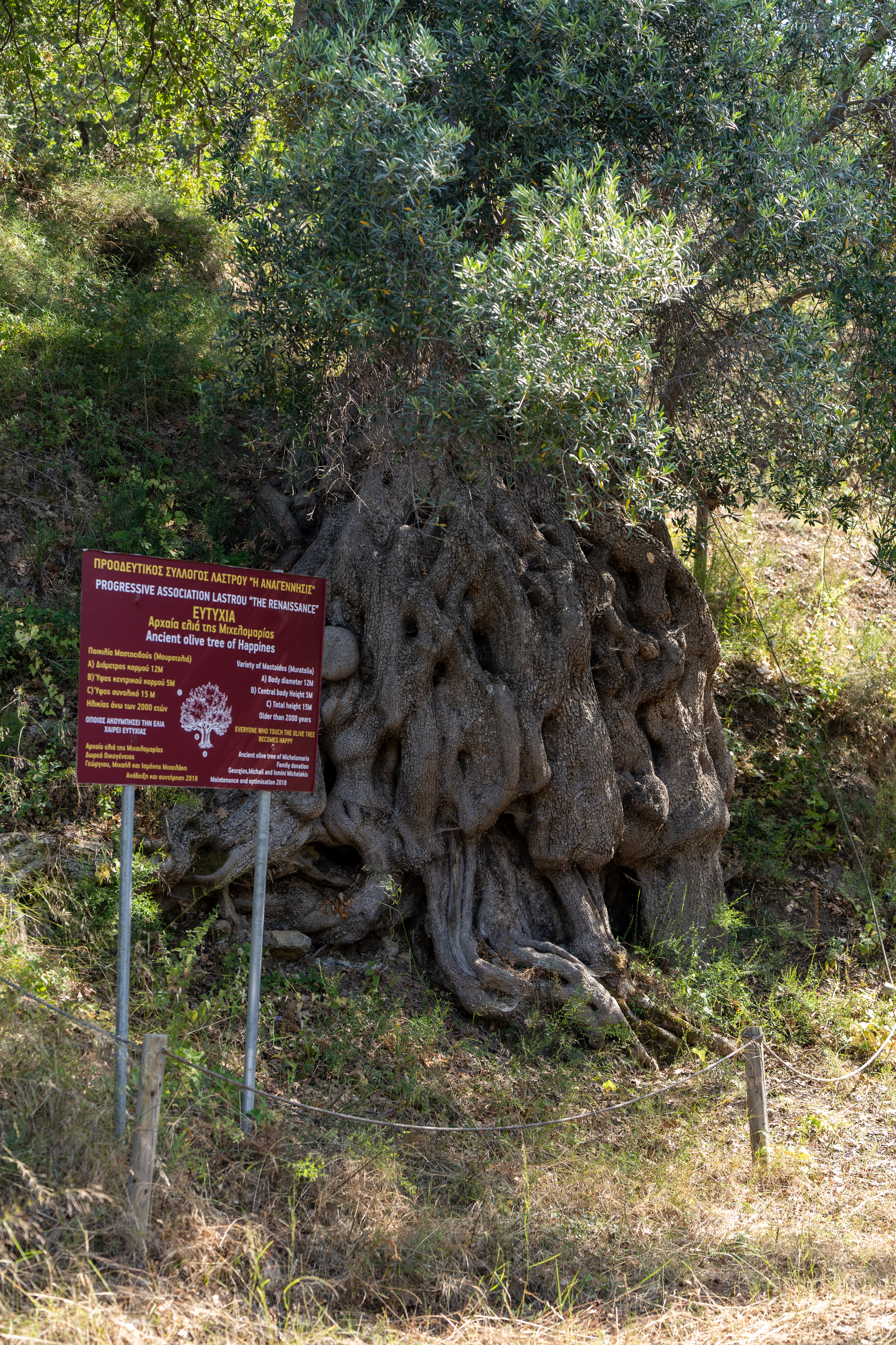
The geotrail starts from the picturesque village of Lastros, where a Minoan settlement has been discovered. Southwest of the village lies the Late Minoan cemetery, where a bronze sword, pottery, and a clay female figurine were found. Within the village, the Byzantine church of Saint George is preserved, and we can visit the monumental olive trees of "Mathaina" and "Michelomaria."
East of the village, the hiking trail begins from the marked point on the VOAK (Northern Crete Highway) and follows an uphill path. Continuing, we pass through the impressive fault line of Lastros (or "stefanies" as the locals call it), along with terraced fields and dry stone walls that are still visible today. These were used by landowners to delineate areas for sowing and cultivation.
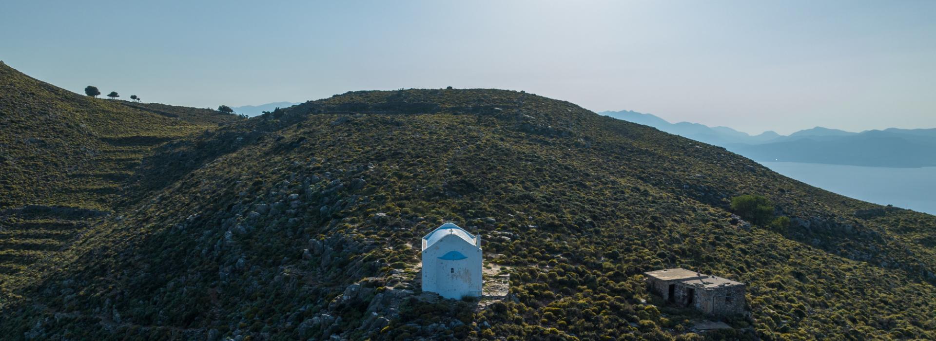
Next, we proceed towards the summit of Mount Kapsa and the chapel of Saint John. During the ascent, we can enjoy the stunning views of the imposing Sitia mountain ranges, and upon reaching the summit, the panoramic view towards the Merabello bay and the Lassithi mountains will reward us.
Along the route, we observe the characteristic "pezoules" (terraces) and dry stone walls that served as natural dividers and boundaries for the fields and crops of the people in the past.
For more informations, check Sitia's Geopark official site
The geotrail is a result of the research project Joint Innovative Activities for Outdoor Tourism-JoinOut. The project entitled "Partnership of Innovative Rural Tourism Actions" and distinctive title: "JoInOuT", is implemented within the framework of the Action "Cooperative Innovation Formations/SCC" - 2nd Call: Businesses" and is financed by the European Regional Development Fund (ERDF) and by National Resources in the context of the Operational Program "Competitiveness, Entrepreneurship and Innovation (EPANEK)" of the NSRF 2014-2020" (Project code: ΓΓ2CL-0359457).


