Ierapetra
Ierapetra Municipality
E4.84 Pefki - Makrygialos
We walk along the narrow, picturesque alleys of the village of Pefki (1) and follow the asphalt road south-west of the village for approximately 250 m. We then turn left into a rough dirt road (2), which passes through an olive grove and then leads us to a footpath which passes next to an old watermill (3).
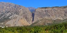
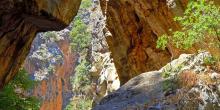
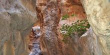
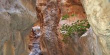
The unsurfaced road runs along the edge of the western wall of the gorge of Pefki for approximately 500 m; next it turns right and descends to the bed of the gorge (4), which features exceptionally beautiful formations and dense vegetation.
E4.83 Dafni - Pefki
We set off at the Dafni village square (1) in a southerly direction. We pass next to the cemetery and take a dirt road that goes left (eastwards), parallel to a steep slope.
Approximately 900 m after the village, at the end of the steep slope, we leave the dirt road and take a vague path (2), in a rather south-easterly direction. After approximately 700 m, we come upon another unsurfaced road (3), which we follow southwards.
E4.82 Orino - Chrysopigi - Dafni
From the Orino village square (1), we follow the asphalt road eastwards for 1 km, to a saddle; once there, we turn left into a dirt road (2), which we follow for approximately 1.200 m, and then come upon a left side road (3). At this point, right (east) of the main dirt road we distinguish an old, vague footpath, which we follow.
Within a few metres on the path we come upon an electricity pole; having passed through a small flat area, approximately 20 minutes down the path, we reach a scree area which we cross through. Remnants of an old boundary fence can be seen on our right.
E4.81 Thripti - Orino
From the central flat area (1) of Thripti, we set off eastwards on a road which presentlyturns north-eastwards and after 500 m we come to a crossroads.
We continue straight for another 450 m, passing along the slope, among scattered farmhouses; then, the uphill road begins to turn eastwards. We ignore a right-hand side road and immediately after a left one and continue for 550 m, still on the main unsurfaced road which winds on the slope.
E4.80 Thripti - Kavoussi
We walk northwards, on the road that passes through the clusters of houses, from the central area (1) of the Thripti settlement; after 600 m, at its northernmost point, on the right-hand side of a characteristic evergreen oak (2), we go down a few steps that lead us to a dirt road, which we follow for approximately 400 m. We continue straight northwards, just where the dirt roads cross (3).

