Festos
Festos Municipality
E4.57 Rouvas - Zaros
From Agios Ioannis, we follow the water courseuntil its confluence with the main water course of Rouvas (1). We then walk along the northern bank, until the entrance to the gorge of Agios Nikolaos, also known as Gafari gorge or Rouvas gorge (2).
We cross the water course and pass onto the footpath that has been constructed on the eastern bank of the gorge.
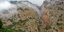
The path by now passes through the main part of the gorge, a little higher up than the water course level, underneath trees.
E4.55-56 Nida - Rouvas
From the water spring of Analipsi, we descend to the main dirt road (1), which goes along the western side of the plateau of Nida and heads southwards, towards Poros tis Milias. We follow it for approximately 1.600 m, covering a big part of the plateau, until we come to a side road (2) with an easterly direction, on our left side, which leads us to the valley of Varsamos.
We continue for about 2,2 km, until we get deep into the valley and reach a point where the unsurfaced road branches off (3).
E4.54 Kamares - Zaros
From Kamares (1), we follow the asphalt-paved, slightly uphill road eastwards; after 2 km, the village of Vorizia comes into view. One of the many gorges of the southern part of Psiloritis opens out on our left.
We begin to descend, until we get to the first houses of the village (2).
E4.53 Akolita - Kamares
The footpath from the top of Timios Stavros leads to the area of Akolita (1) and then splits; its eastern branch leads to the plateau of Nida, while its southern one to Kamares. The latter, after 1 km comes to a dirt road (2), which we follow initially eastwards and then southwards.
There are quite a few stone dairy huts (mitata) in the area, where we can take shelter, if need be.
E4.52 Zominthos - Nida
Following the asphalt road, immediately after the archaeological site of Zominthos, we come to a designated rest area on our right, where there is a chapel of Agia Marina (1).
We continue on the main road, which meanders on the slopes, having a view to the area of Zominthos.
On the low hills around the valley, a great number of shepherds’ stone dairy huts (mitata) can be seen.
Little by little, the vegetation begins to thin out; by the time we reach the area of Mithia (2), after approximately 4 km, the landscape is totally bare.
E4.51 Anogia - Zominthos
South of Perachori (1), a settlement of the Anogia area, an uphill path begins; it passes by the church of Agios Nektarios, then passes through a small thicket of pines and cypresses and leads up to the hill top (2).
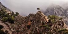
From the ridge, the footpath descends towards the bare valley. There is a stream (3) down below; having crossed it, we climb again for a while, until we reach a second ridge (4). A low peak is on our right side, where a stone hut can be seen. We cross the dirt road which goes along the ridge and descend again to a dry water course (5), which we cross.
E4.50 Garazo - Zoniana - Anogia
From Garazo (1), we follow the main road to Anogia for approximately 600 m. We then turn right at the fork (2), towards the village of Omala (3), where we arrive after 900 m on an asphalt road.
We pass through the village and follow the road for 200 m; this leads us to a crossroads of a main dirt road, which we take in a south-easterly direction.
E4.41 Timios Stavros (Psiloritis Summit) - Akolita - Nida
To descend to Nίda from the summit of Timios Stavros (1), we follow the mountain line until the saddle (2) with Agathias.
Once there, we reach (on our right-hand side, towards the south) the footpath which leads down to the shelter of the Mountaineering Club of Rethymnon.
We continue straight on, eastwards, on a slightly uphill path, and reach the northern slope of Agathias (3).
When covered with snow and frost, this section of the route may become very dangerous.


